 Free
Free
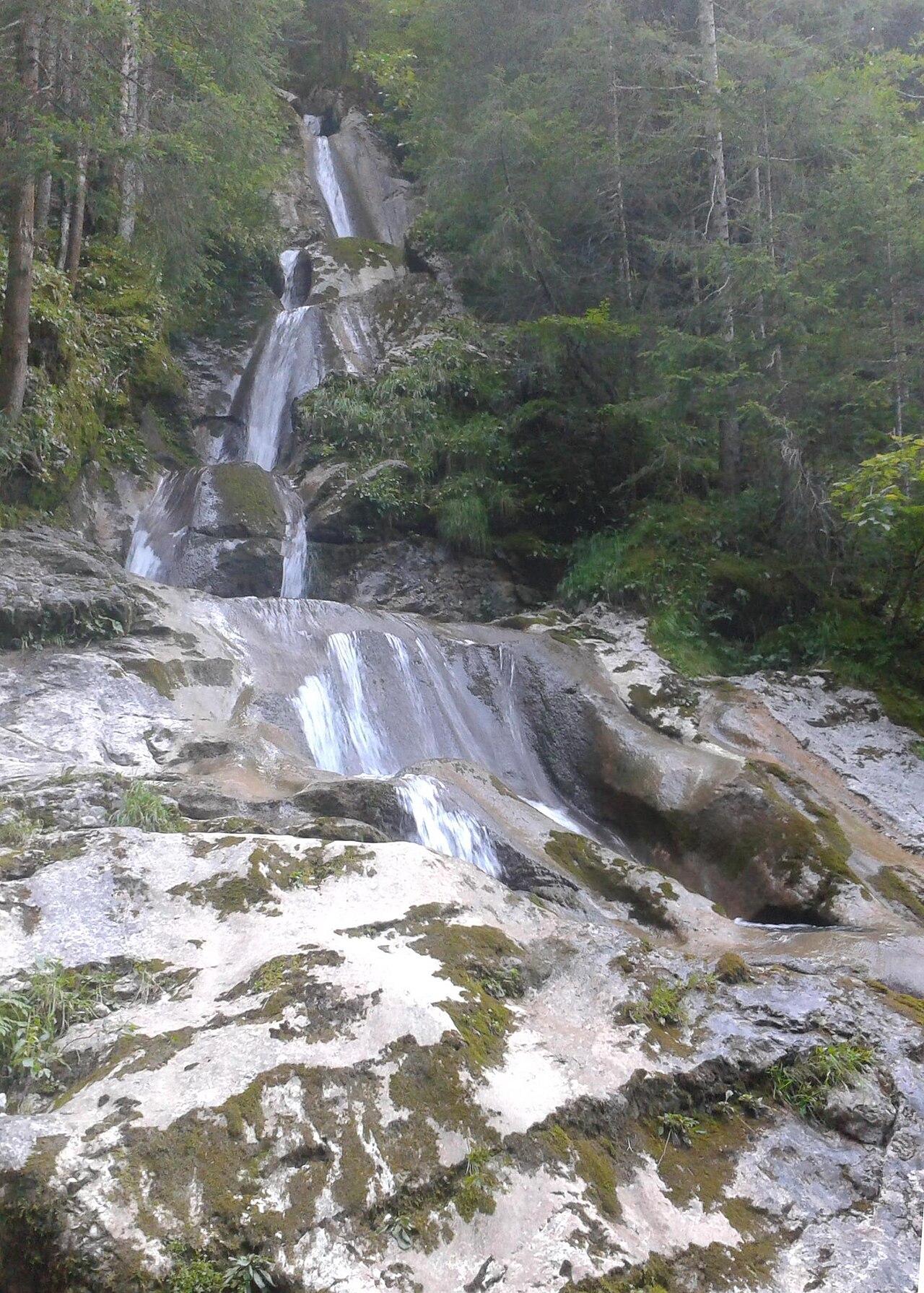
Cascade de la Diomaz
Bellevaux
Waterfall with natural potholes and Chartreux cross, 30 min walk from Vallon Lake. Free access year-round in Bellevaux, Haute-Savoie.
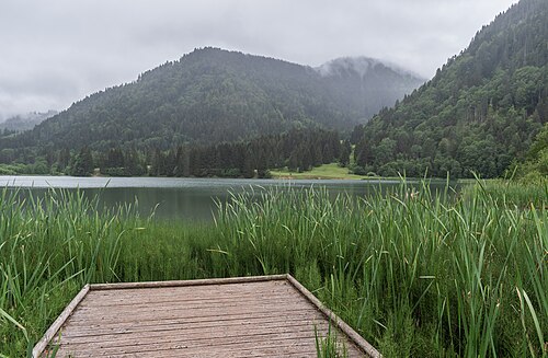
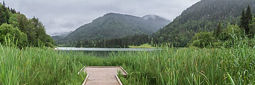
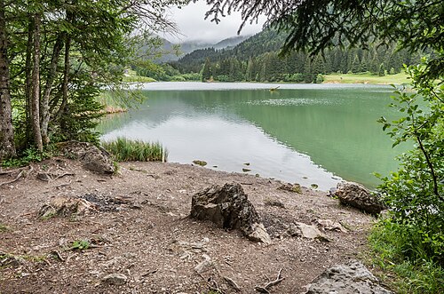
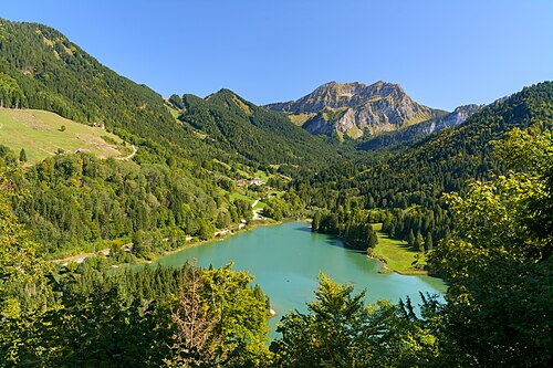
Fifteen hectares of emerald water at 1080 m altitude, born on the night of 11–12 March 1943 when the mountain slid and blocked the Brévon river. Beneath the surface lie the ruins of a submerged hamlet. At the foot of Roc d'Enfer, in La Chèvrerie, commune of Bellevaux.
Location verified by loisirs74.fr
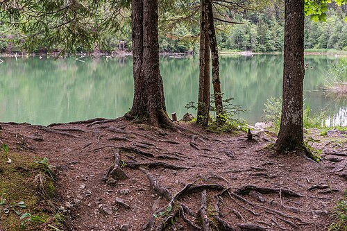
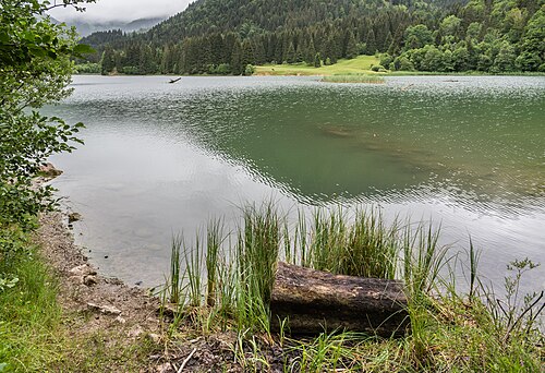
The Lac de Vallon is a 15-hectare mountain lake at 1080 m altitude in the hamlet of La Chèvrerie, in the commune of Bellevaux. It formed on the night of 11–12 March 1943, when a mudslide swept away about ten chalets and blocked the course of the Brévon river. Water accumulated behind this natural dam, submerging the hamlet of L'Écondu, whose foundations can still sometimes be seen beneath the surface.
It is the youngest lake in the Chablais. It is recognised as a key geosite of the UNESCO Chablais Global Geopark and has been classified as a Natural Zone of Ecological, Faunistic and Floristic Interest (ZNIEFF) since 1991. Maximum depth: 16 m. Free, open access year-round. Camping, bivouac and fires are prohibited on site. Access from Bellevaux is by car to the lakeside car park, then a few minutes' walk on a flat path. The site is open April to November depending on snow cover, ideal for a half-day visit or lakeside picnic.
Been there? Share your photos — we'll add them to this page with credit. Tag #loisirs74 or email photos@loisirs74.fr
No. Access to the Lac de Vallon is free and open year-round, every day. Only fishing requires a permit, issued by APPMA and sold at the OT des Alpes du Léman.
The Lac de Vallon formed on the night of 11–12 March 1943, during a landslide that blocked the course of the Brévon river. About ten chalets were swept away, and the submerged hamlet of L'Écondu now lies beneath the water.
Swimming in the Lac de Vallon is not mentioned as a permitted activity by official sources. The site is primarily for walking, fishing and geological discovery.
Yes. The Lac de Vallon is open to fishing from 1 April to 8 October, every day, with a mandatory permit via APPMA. Species present: brown trout, rainbow trout, Arctic char, minnow. Classified as difficult.
The interpretation trail around the Lac de Vallon takes about one hour. Geopark panels along the route tell the story of the lake's formation and the submerged hamlets.
No. Camping, bivouac and fires are strictly prohibited on the site of the Lac de Vallon. Accommodation is available in Bellevaux and La Chèvrerie.
Yes, dogs are allowed at the Lac de Vallon according to the Geopark factsheet. Keeping them on a leash is recommended out of respect for the wildlife of the site, classified ZNIEFF since 1991.
Yes. A dedicated car park is located right next to the Lac de Vallon, reachable by car up to the foot of the site from Bellevaux via the La Chèvrerie road.
Yes. The Lac de Vallon is recognised as a key geosite of the UNESCO Chablais Global Geopark, and classified as a Natural Zone of Ecological, Faunistic and Floristic Interest (ZNIEFF) since 1991.
Multi-source verification at publication. Information may change — confirm with the official operator before travelling.
Nearby
Other places to explore in the area and in the same category
Free
Waterfall with natural potholes and Chartreux cross, 30 min walk from Vallon Lake. Free access year-round in Bellevaux, Haute-Savoie.
 Paid
Paid
Treetop adventure park at Bellevaux (74): 8 trails, 70 workshops, ziplines from age 3. Children's island €10, ages 6–16 €17, adult €23. May to October.
 Free
Free
Small free alpine garden in Bellevaux (Chablais), behind the church: mountain plants — edible, toxic, medicinal — pond and play area.
 Free
Free
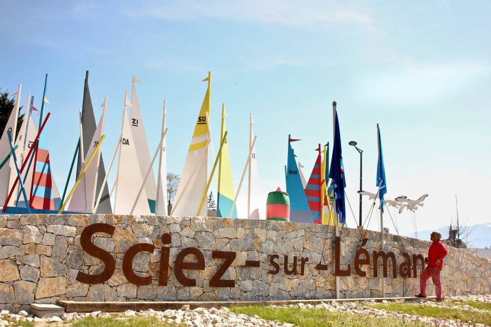
Grassy Lake Geneva beach with supervised swimming in summer, dog area, games, boules and ping-pong. Free access year-round in Sciez, Haute-Savoie.
 Free
Free
String of natural pebble beaches spanning 3 km on Lake Léman, bordering Ripaille Castle estate. Free access, protected shoreline.
 Free
Free
Free Blue Flag beach on Lake Léman, supervised swimming in summer, adjacent to Châtaigneraie park in Thonon-les-Bains, Haute-Savoie.