 Free
Free
Maison du Salève Trails
Présilly
Network of interpretation trails around the Maison du Salève at Pomier-Présilly: Petites Croix, Convers and Orjobet circuits plus the Chartreuse de Pomier.
Mont Salève, the 'Balcony of Geneva' — a pre-Alpine massif at 1,379 m linked to Geneva by a historic cable car inaugurated in 1932.

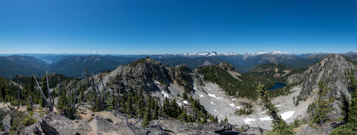
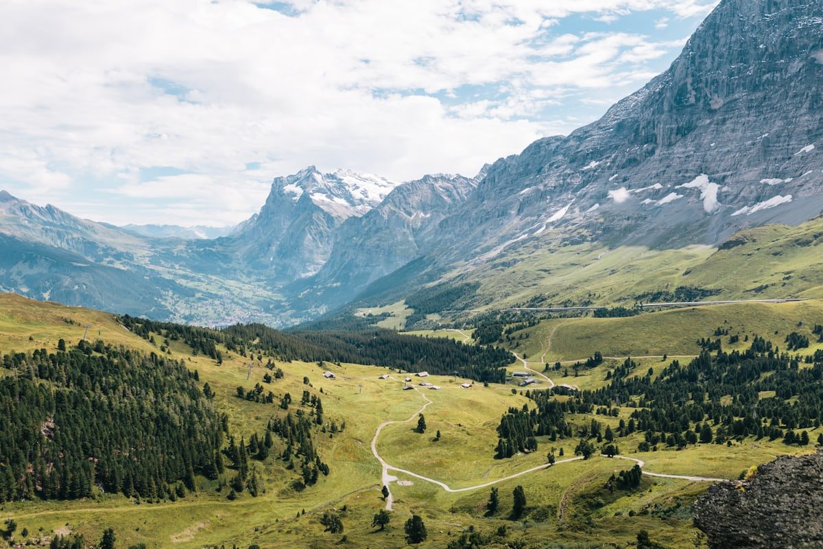
Mont Salève, known as 'Geneva's Balcony', is a Haute-Savoie pre-Alpine massif rising to 1,379 m at the Grand Piton. It stretches between Étrembières to the north and the Pont de la Caille to the south, forming a long limestone wall visible from the entire Geneva basin. The site is classified Natura 2000 for its rich flora and fauna (chamois, peregrine falcons, salamanders).
The most iconic access is the Salève cable car, opened in 1932 and now operated by Geneva Public Transport (TPG). It links Étrembières to 1,100 m in under five minutes. 2026 season: open daily from 1 April to 1 November, 09:00-18:45, with evening hours Thursday-Saturday until 22:45. 2026 rates: adult return €13, child €5.80, family pass €49, 10-trip carnet €75. A Unireso combo at CHF 21 bundles a Geneva TPG day pass zone 10 + the cable-car round trip.
At the top, 250 km of marked trails criss-cross the massif — hiking, mountain biking, trail running, climbing. It is also one of the region's most popular paragliding sites, with schools offering tandem baptism flights (Salève Airlines and others). The summit offers an exceptional panorama of Geneva, Lake Geneva, the Jura and, in clear weather, the Mont Blanc range.
Free trail access if you walk or cycle up. Several car parks at the foot of the massif (Étrembières, Veyrier, Mornex). Restaurants at the top and at the base. To reach the cable car from Geneva without a car: TPG tram to Veyrier Douane, then 9 min on foot.
From Annecy: A41 then A40 to Geneva, exit Étrembières-Le Salève. Free parking at the foot of the cable car. Allow 40 min from Annecy.
Open in MapsFrom Geneva (Cornavin): TPG tram to Veyrier Douane, then 9 min walk to the cable car. CHF 21 Unireso combo (tram + cable-car return).
Open in MapsGreater Geneva cycle network. MTB climb possible via several marked routes.
Open in Maps
Been there? Share your photos — we'll add them to this page with credit. Tag #loisirs74 or email photos@loisirs74.fr
2026 prices: adult return €13, child €5.80, family pass €49, 10-trip carnet €75. A Unireso combined ticket at CHF 21 (TPG zone 10 day pass + cable car return) is available.
2026 season: daily from 1 April to 1 November, 9 am-6.45 pm. Evening openings on Thursday, Friday and Saturday until 10.45 pm.
TPG tram from Cornavin to the Veyrier Douane stop, then a 9-minute walk to the cable car. The Unireso combined ticket at CHF 21 covers both legs.
No, access to the massif's trails is free and open year-round. Only the cable car and the summit restaurant are paid.
Yes, it's one of the region's flagship paragliding sites. Salève Airlines and other schools offer tandem flights from the summit — booking recommended.
About 250 km of way-marked trails cover the whole massif — hiking, mountain biking, trail running, from family routes to technical lines.
The cable car is closed from 1 November to 31 March. The trails remain open on foot or with snowshoes depending on snow cover — beware of ice on the rocks.
A 360° view over Geneva and Lake Geneva, the Jura to the west, the Annecy basin to the south-east and, on a clear day, the Mont Blanc range.
Multi-source verification at publication. Information may change — confirm with the official operator before travelling.
Nearby
Other places to explore in the area and in the same category
Free
Network of interpretation trails around the Maison du Salève at Pomier-Présilly: Petites Croix, Convers and Orjobet circuits plus the Chartreuse de Pomier.
 Paid
Paid
Pathé Archamps is a next-generation multiplex right next to the Swiss border, with a large IMAX auditorium, a 4DX room (motion seats + effects), Dolby Atmos screen
 Paid
Paid
 Free
Free
Highest road pass on Le Salève at 1,335 m. Spectacular views of Mont-Blanc, Lake Léman and Geneva. Free access for hikers and cyclists year-round.
 Paid
Paid
Cable car from Étrembières (432 m) to the summit of the Salève (1,097 m) facing Geneva. Adult return EUR 18, open 9 a.m. to 10:45 p.m. Thu-Sat. Free exhibition.
 Free
Free
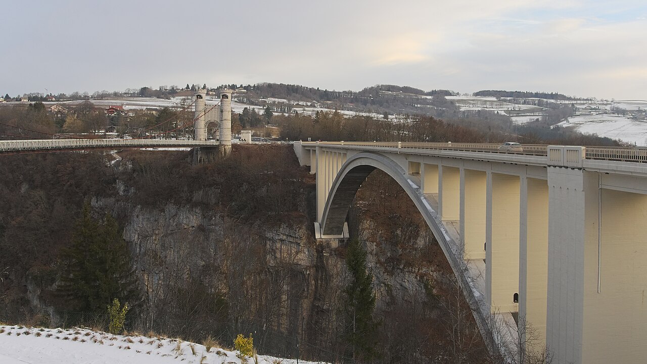
Suspension bridge from 1839, 180 m long, 147 m above the Usses. Historic Monument, interpretation trail, free access. Cruseilles, Haute-Savoie.