 Free
Free
Maison du Salève Trails
Présilly
Network of interpretation trails around the Maison du Salève at Pomier-Présilly: Petites Croix, Convers and Orjobet circuits plus the Chartreuse de Pomier.
Highest road pass on the Le Salève massif (1,335 m), at the foot of Grand Piton. Popular with cyclists (6 climbing routes) and gateway to summit hiking trails.

The Col des Pitons is the highest road pass on the Le Salève massif, located at 1,335 m elevation on the D41A, between Col de la Croisette (1,176 m) and Cruseilles. It sits at the foot of Grand Piton (1,379 m), the massif's highest point, crowned by the Bastian Tower. This historic tower, built between 1820 and 1830 by Claude-François Bastian, a notary and mayor of Frangy, stands on the site of a 14th-century lookout post. The pass is accessible by car, bike, and on foot, with dedicated parking on-site.
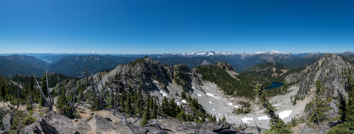
Le Salève, nicknamed the "balcony of Geneva," is a Pre-Alps mountain in Haute-Savoie but belongs geologically to the Jura chain. Col des Pitons is particularly popular with cyclists: six climbing routes are mapped, from easiest (Cruseilles, 7.5 km at 4.8% average gradient) to most challenging (Collonges-sous-Salève, 11.7 km at 7% average with sections exceeding 12%). For hikers, the pass serves as a starting point or waypoint toward Grand Piton, Thuile alpine pasture, or various trails on the GR Balcon du Léman. At the Grand Piton summit, an orientation table helps identify Alpine and Jura peaks, while an engraved cartouche recalls the passage of Lord Byron and Alphonse de Lamartine, author of a famous poem dedicated to Le Salève.
The road to the pass winds through forest for most of the route, then opens to panoramic views in the final kilometres: Mont-Blanc to the east, Geneva basin and Lake Léman to the north, Jura chain to the west. The Pitons sector features a limestone pavement plateau (karst formation) among Le Salève's finest. Each summer, the Haute-Savoie Departmental Council organizes "Haute-Savoie Au Sommet": the D41A closes to motorized vehicles certain Tuesday mornings (9am–12pm) and is reserved exclusively for cyclists. In 2026, Col des Pitons will host this event on July 7, allowing touring cyclists of all levels to climb the pass safely, without motorized traffic.
From Annemasse (~30 min), reach Collonges-sous-Salève then climb D41 via Col de la Croisette (switchback road, 7 km). From Cruseilles (~20 min), take D41A toward Col des Pitons (steady climb, 10 km). Free parking at pass (spaces limited weekends). Road closed in winter beyond Grotte du Diable.
Open in MapsPopular cycling pass: 6 climbing routes mapped. South route (Cruseilles): 7.5 km / 4.8% average (easiest). West route (Collonges): 11.7 km / 7% average, 12%+ sections (hardest). Other routes: La Muraz, Annemasse, Mont Sion, Malbuisson. "Haute-Savoie Au Sommet" event on July 7, 2026: road closed to cars (9am–12pm) and reserved for cyclists.
Open in MapsTransport data verified on 2026-06-15 · source transport.data.gouv.fr (Licence Etalab 2.0)
Been there? Share your photos — we'll add them to this page with credit. Tag #loisirs74 or email photos@loisirs74.fr
No. Access to Col des Pitons is free and complimentary year-round. Pass parking is also free (spaces limited in peak season; arrive early on weekends).
Col des Pitons can be climbed via 6 different routes. The easiest is the south route from Cruseilles (7.5 km, 4.8% average). The hardest is the west route from Collonges-sous-Salève (11.7 km, 7% average, sections exceeding 12%). Other possible starting points: La Muraz, Annemasse, Mont Sion, Malbuisson.
No. The road to Col des Pitons closes in winter (November–March approximately) from Grotte du Diable, 1.5 km before the pass. The final section is not snow-cleared. Full access reopens May through October depending on weather.
Col des Pitons (1,335 m) is the highest road pass on Le Salève, accessible by car and bike. Grand Piton (1,379 m) is the massif's summit, accessible only on foot from the pass (45 min hike). Bastian Tower stands at Grand Piton.
Yes. Col des Pitons offers panoramic views of Mont-Blanc to the east, the Geneva basin and Lake Léman to the north, and the Jura chain to the west. The most spectacular views are at Grand Piton (45 min hike from the pass), where an orientation table is installed.
Yes. Col des Pitons is a starting point for several hikes: to Grand Piton (45 min one-way), to Thuile alpine pasture, or along the GR Balcon du Léman. Marked trails, moderate elevation gain but uneven karst terrain. Hiking shoes recommended.
At Grand Piton (1,379 m), you'll find the Bastian Tower built between 1820 and 1830, an orientation table, a magnificent limestone pavement plateau (karst formation), and an engraved cartouche recalling the passage of Lord Byron and Alphonse de Lamartine. Exceptional panoramic view over Geneva, Lake Léman and the Alps.
In 2026, the Haute-Savoie Au Sommet event at Col des Pitons takes place on Tuesday, July 7 from 9am to 12pm. The D41A is closed to cars and reserved for cyclists. Free, no registration, open to all levels.
Free parking is available directly at Col des Pitons. Spaces are limited, especially on weekends in peak season (June-September). Arrive early in the morning or late afternoon to find parking easily. Parking also available at La Croisette (2 km below).
Multi-source verification at publication. Information may change — confirm with the official operator before travelling.
Nearby
Other places to explore in the area and in the same category
Free
Network of interpretation trails around the Maison du Salève at Pomier-Présilly: Petites Croix, Convers and Orjobet circuits plus the Chartreuse de Pomier.
 Paid
Paid
Pathé Archamps is a next-generation multiplex right next to the Swiss border, with a large IMAX auditorium, a 4DX room (motion seats + effects), Dolby Atmos screen
 Paid
Paid
 Paid
Paid
Cable car from Étrembières (432 m) to the summit of the Salève (1,097 m) facing Geneva. Adult return EUR 18, open 9 a.m. to 10:45 p.m. Thu-Sat. Free exhibition.
 Paid
Paid
Pre-Alpine massif at 1,379 m known as 'Geneva's Balcony': historic cable car from Étrembières (€13 adult), 250 km of trails, Natura 2000 site.
 Free
Free
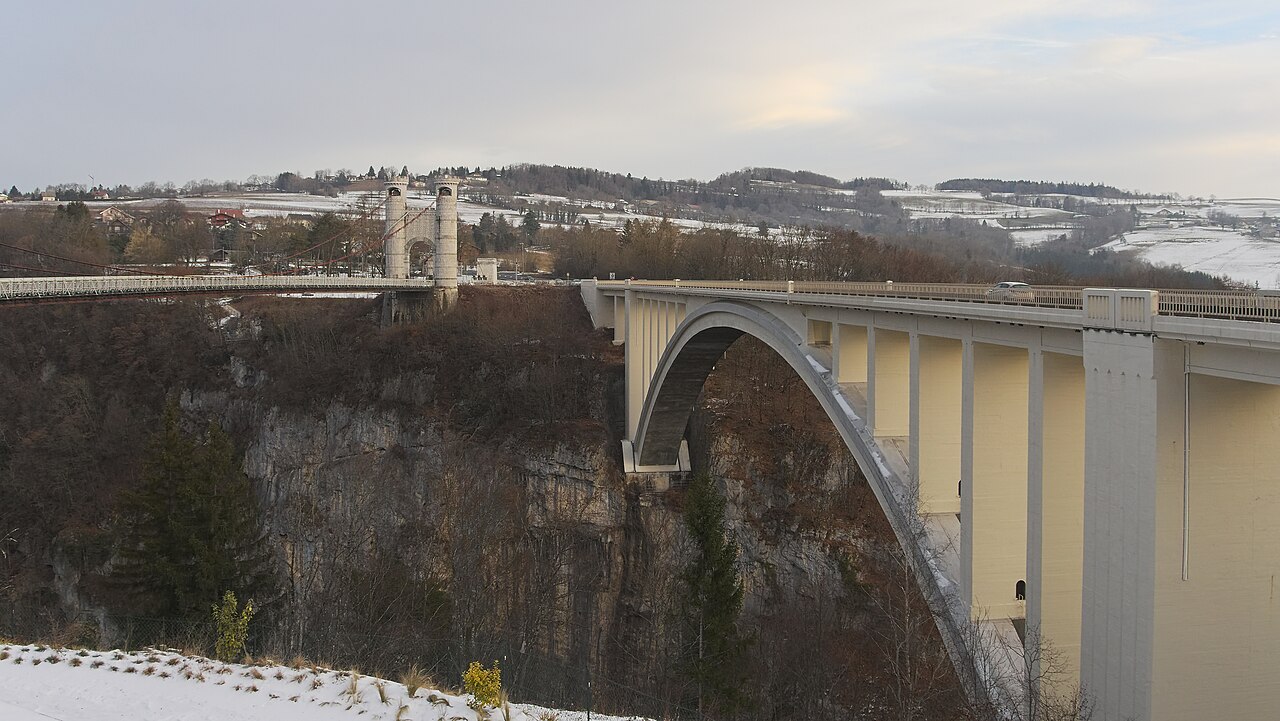
Suspension bridge from 1839, 180 m long, 147 m above the Usses. Historic Monument, interpretation trail, free access. Cruseilles, Haute-Savoie.