 Free
Free
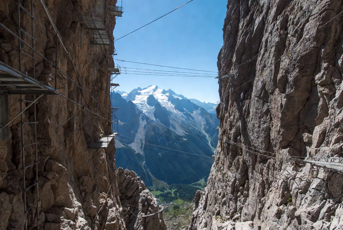
Via ferrata Yves Pollet-Villard
La Clusaz
700 m equipped route, graded D (difficult), on the Borderan cliff facing the Étale massif. Free access, gear required, open May–November.
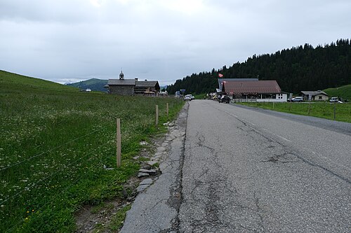
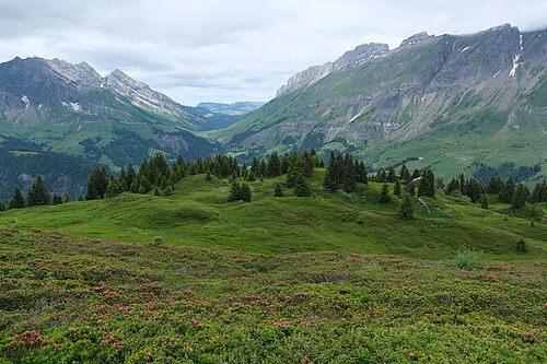
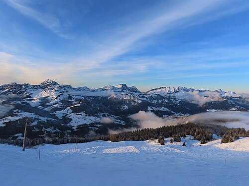
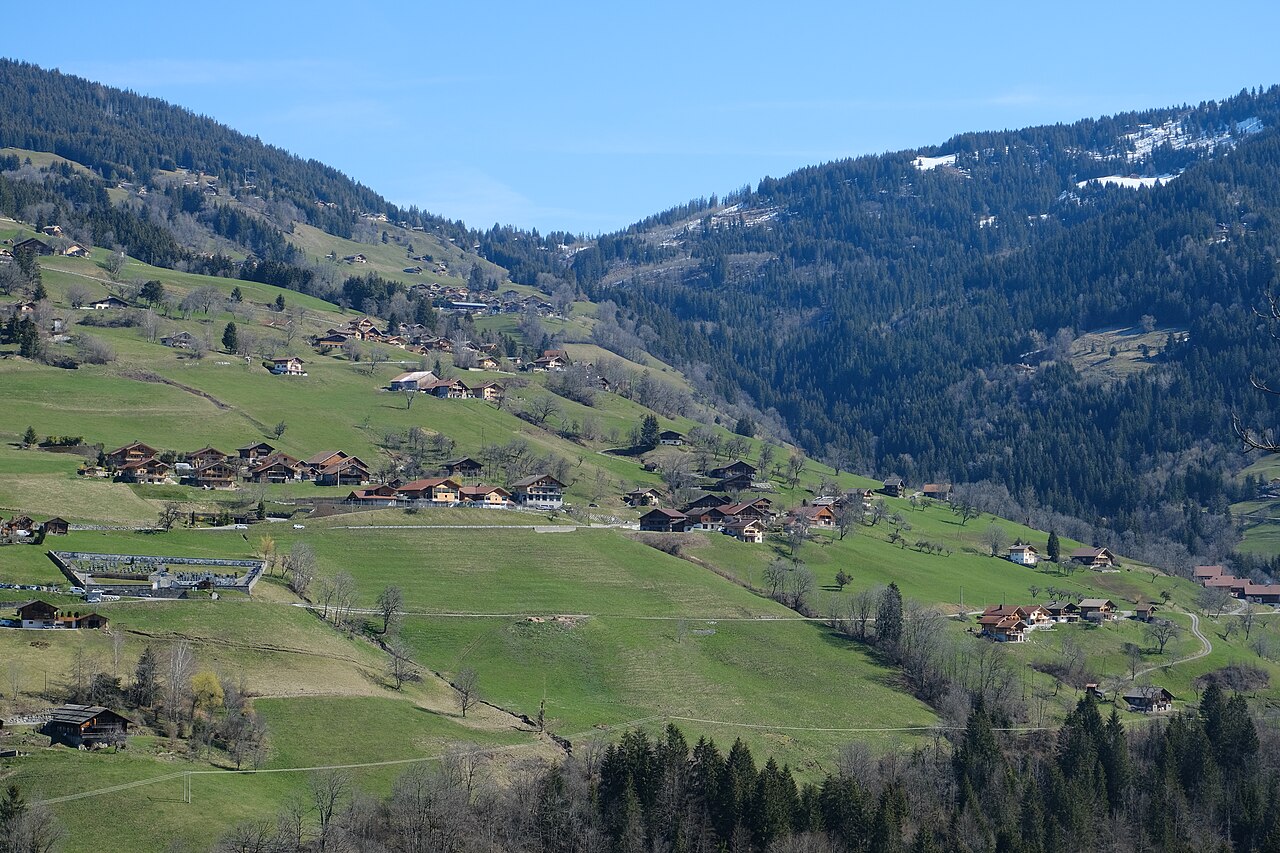
The Col des Aravis links La Clusaz, in Haute-Savoie, with La Giettaz, in Savoie, at 1,486 m. It is the lowest pass through the Aravis range: open view of the Mont-Blanc massif, Sainte-Anne chapel, alpine meadows, hiking trailheads.
Location verified by loisirs74.fr
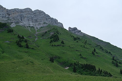
The Col des Aravis is a road pass at 1,486 m that separates the commune of La Clusaz, in Haute-Savoie, from La Giettaz, in Savoie. It is the lowest point through the Aravis range, a chain extending 25 km from north to south, from Bonneville to Ugine, culminating at Pointe Percée (2,752 m).
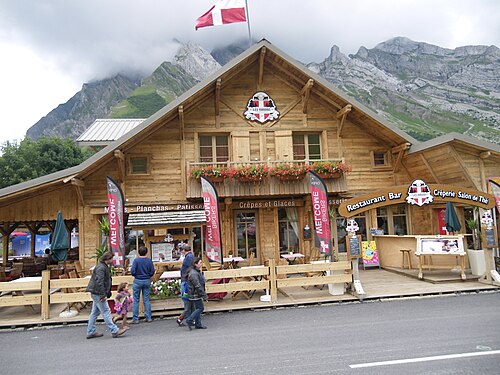
The pass is crossed by the D909 departmental road, opened in 1902, today a stage of the Route des Grandes Alpes® linking Thonon-les-Bains to Nice. On site: the Sainte-Anne chapel, restaurants, souvenir shops, alpine farms selling Reblochon cheese directly, parking areas, and hiking trailheads. On a clear day, open view of the Mont-Blanc massif. The pass also welcomes cyclists and bikers who tackle this legendary ascent.
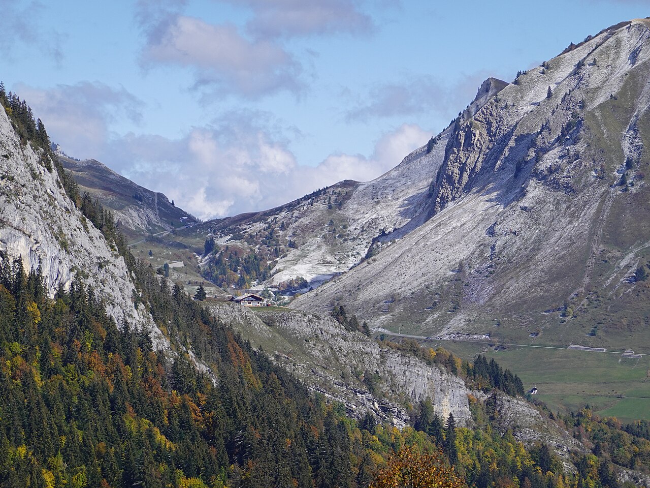
The history of the pass is closely linked to the tourist development of La Clusaz: the opening of the road in 1902 marked the beginning of the resort's expansion. Today, the Col des Aravis is a must for mountain lovers, hikers and touring cyclists. The alpine depression where the chapel stands is framed by the cornices of the Etale and the spectacular opening of the Porte des Aravis to the north.
From La Clusaz, take the D909 towards Flumet / La Giettaz, 7 km to the pass. From Thônes to the north-west: 18.9 km on the D909 (Fier valley). From Flumet to the south-east: 11.5 km on the D909 (Val d'Arly). The road is sometimes closed in winter during heavy snowfall.
Open in MapsFree Aravisbus shuttle (line 1) in high season from La Clusaz.
Open in MapsClassic climb of alpine cycling. From Flumet: 11.7 km, average gradient ~4.9%. From Thônes: 18.9 km, average gradient ~4.6%. The pass is a stage of the Route des Grandes Alpes® (Thonon-les-Bains → Nice).
Open in MapsTransport data verified on 2026-06-15 · source transport.data.gouv.fr (Licence Etalab 2.0)
Been there? Share your photos — we'll add them to this page with credit. Tag #loisirs74 or email photos@loisirs74.fr
The Col des Aravis is at 1,486 m between La Clusaz (Haute-Savoie, 74) and La Giettaz (Savoie, 73), on the D909. It marks the boundary between the two departments.
No. Access to the Col des Aravis is free, as the pass is crossed by a public departmental road. Free parking on site.
The Col des Aravis reaches 1,486 m, which makes it the lowest road pass crossing the Aravis range.
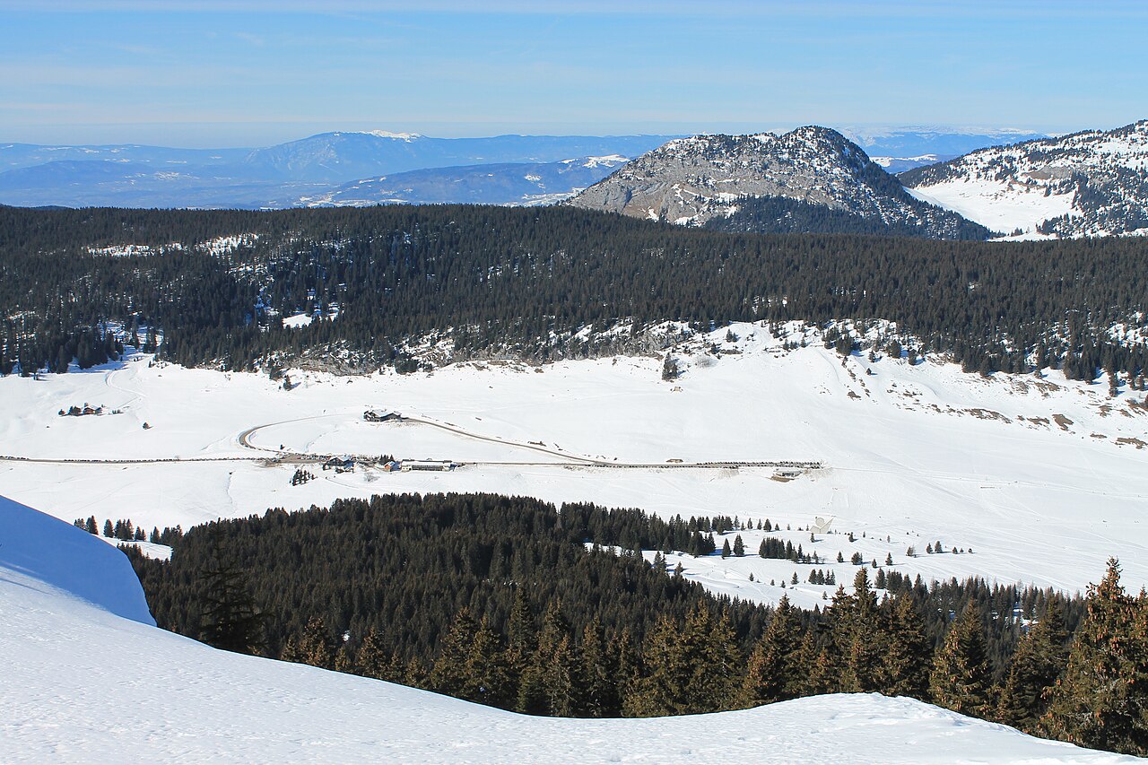
Yes, the D909 over the Col des Aravis stays open for most of the winter. It may be closed exceptionally during heavy snowfall (about 5 days a year on average). Check road conditions before travelling.
Yes, on a clear day. The Col des Aravis offers an open view of the Mont-Blanc massif, which makes it one of the most popular road viewpoints in the area.
Yes. Several trails start from the Col des Aravis, including the Croix de Fer and chalet du Curé loop on the La Giettaz side, and the climb to the Porte des Aravis. Check with the tourist office for conditions and waymarking.
Yes, the Col des Aravis is historically crossed by the Tour de France, most recently in 2020 according to available sources. It is also part of the Time Megève Mont-Blanc cyclosportive.
Yes. Several alpine farms at the Col des Aravis sell directly in season. Reblochon is the historic cheese of the Aravis range.
Yes. The pass is accessible by car with parking at the top, restaurants on site, and several easy walks in the alpine meadows. The chapel and grazing cows usually interest children.
From May to October, early morning or late afternoon to avoid car traffic. Summer mornings often offer the best visibility of Mont-Blanc.
Multi-source verification at publication. Information may change — confirm with the official operator before travelling.
Nearby
Other places to explore in the area and in the same category
Free
700 m equipped route, graded D (difficult), on the Borderan cliff facing the Étale massif. Free access, gear required, open May–November.
 Paid
Paid
Playful 7-module wooden-ball trail at La Clusaz: from the Patinoire cable car top down to the Bossonnet woods. Mountain summer.
 Paid
Paid
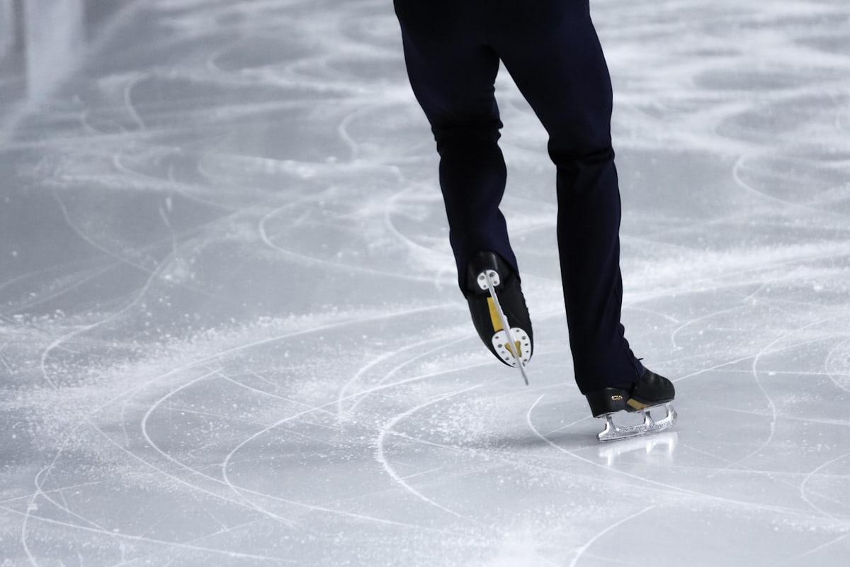
1,000 m² covered ice rink in La Clusaz, open late December to end April: public sessions, night skating, Monday Eisstock. From €5.
 Free
Free
Mountain pass at 1,477 m between Manigod and La Clusaz, popular with cyclists, family ski resort in winter and hiking starting point in summer.
 Free
Free
Limestone plateau at 1,450 m altitude, major French Resistance memorial site. National monument, historical trail, cross-country skiing, hiking. Free access.
 Free
Free
Legendary 1,613 m Tour de France pass between Le Reposoir and Le Grand-Bornand. Route des Grandes Alpes, Aravis–Bargy panorama, hiking and cycling.