 Paid
Paid
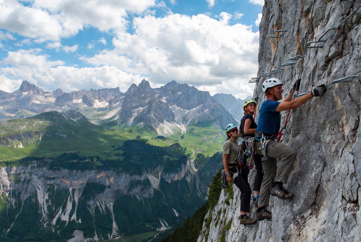
Annecy Mountain Guides (Bureau des guides)
Annecy
Annecy mountain guides office: guided outings — hiking, mountaineering, climbing, canyoning, via ferrata, ski touring.
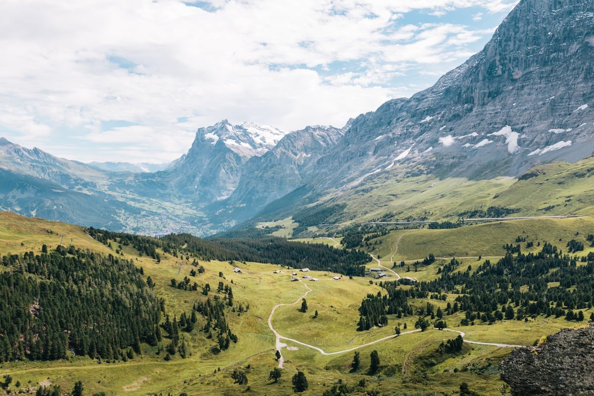
An iconic mountain overlooking Annecy that peaks at 1,291 metres, offering an exceptional panorama of Lake Annecy, the Bauges, Aravis and Mont Blanc from the Sentier des Crêtes.

Mont Veyrier is a mountain located on the eastern shore of Lake Annecy, peaking at 1,291 metres in altitude. It overlooks the municipalities of Annecy (formerly Annecy-le-Vieux), Villaz and Veyrier-du-Lac, and is part of the Bornes massif. With its neighbour Mont Baron (1,299 m), it constitutes one of the most emblematic and most visited peaks in the Annecy basin, accessible directly from Annecy city centre in less than 30 minutes.
Mont Veyrier offers an exceptional 360-degree panorama of Lake Annecy, the Bauges massif, Semnoz, the Bornes, Aravis and, on clear days, Mont Blanc. It is one of the few Haute-Savoie summits offering such diverse landscapes from such an accessible viewpoint. The summit is accessible by numerous waymarked trails that wind through shaded forests of beech and conifers. The famous Sentier des Crêtes (Ridge Trail) connects Mont Veyrier to Mont Baron along limestone cliffs, offering a bird's-eye view of the lake throughout the route with over 800 metres of vertical elevation.
An old cable car, built in 1934 by banker Laydernier, linked Veyrier-du-Lac to the summit of Mont Baron until 1984, carrying up to 69,000 passengers per year in its heyday. The former arrival station was dismantled in 2001, leaving today a concrete platform that serves as a much-prized viewpoint. Two orientation tables help identify the surrounding peaks. A botanical trail at Pré Longé allows visitors to discover local flora, with contrasting vegetation between the sunny south-facing slope overlooking the lake and the cooler, more humid north-facing slope overlooking the Dingy-Saint-Clair gorge.
From Annecy centre (~10 min), follow the Lake Annecy shoreline towards Veyrier-du-Lac via the D909 (Avenue d'Albigny). After the Impérial Palace and Albigny beach, continue for 2 km. Pass through the reed bed district, arrive at the Petit Port roundabout. Park at the large free car park at Annecy-le-Vieux stadium (on the left) or at the small shops car park (100 m further on). The hiking departure starts just after the bakery, at the Bois Jettaz sign, Avenue de Chavoire (path on the right). ATTENTION: since July 2024, vehicle access to Col du Pré Vernet and Col des Contrebandiers is prohibited (municipal order due to overcrowding).
Open in MapsIn summer (1 July–31 August), free bus line 20 from Annecy to Veyrier-du-Lac. Get off at Petit Port / Bois Jettaz stop. Rest of the year, line 20 is paid (Sibra network).
Open in MapsFrom Annecy centre, follow the cycle path along the lake (Voie Verte du Lac d'Annecy) towards Veyrier-du-Lac, then join Petit Port via the D909 (approximately 7 km from the centre). Bike racks at the hiking departure point.
Open in MapsTransport data verified on 2026-06-15 · source transport.data.gouv.fr (Licence Etalab 2.0)
Been there? Share your photos — we'll add them to this page with credit. Tag #loisirs74 or email photos@loisirs74.fr
Yes. Access to Mont Veyrier is free and cost-free year-round. The car parks at Petit Port and Annecy-le-Vieux stadium are also free.
The most common starting point for Mont Veyrier is Petit Port in Annecy-le-Vieux, accessible by car (10 min from the centre) or by bus line 20. The trail starts on Avenue de Chavoire, just after the bakery, at the Bois Jettaz sign.
No. Since the order of 26 July 2024, vehicle access to Col du Pré Vernet and Col des Contrebandiers is prohibited to protect the overcrowded site. You must park at Petit Port and walk up.
From Petit Port, allow 1 hour 30 minutes to 2 hours 30 minutes to climb to the summit of Mont Veyrier depending on your pace. The complete loop with Mont Baron and return takes 4 to 6 hours. Plan to bring enough water (no water source on the route).
Mont Veyrier is accessible to beginner hikers in good physical condition. The ascent from Petit Port is sustained (850 m elevation gain) but without major technical difficulty. The Sentier des Crêtes has secured exposed passages (cables, railings) not recommended for people prone to vertigo.
The best periods for Mont Veyrier are spring (April–June) and autumn (September–October). Visitor numbers are calmer than in summer, temperatures are pleasant and the lake view is often clear. Avoid winter (November–March) without suitable equipment: the ridge can be iced.
In case of rain or fog, it is strongly discouraged to take the Sentier des Crêtes. Rocky passages become very slippery and zero visibility makes progression dangerous. Choose another hike or postpone your outing.
Yes, on clear days, Mont Blanc is visible from the summit of Mont Baron. The orientation tables at the summit make it easy to identify the different Alpine peaks, including the Mont Blanc massif to the east.
Multi-source verification at publication. Information may change — confirm with the official operator before travelling.
Nearby
Other places to explore in the area and in the same category
Paid
Annecy mountain guides office: guided outings — hiking, mountaineering, climbing, canyoning, via ferrata, ski touring.
 Free
Free
Blue Flag since 2009 (confirmed 2026). 7,000 sqm of lawn and sandy banks with paddling pool, T-shaped pontoon, diving board, snack-restaurant. Tiralo on site.
 Free
Free
The largest free beach on Lake Annecy: 400 m of grass and sand, summer lifeguards, free showers and toilets. Albigny district, Annecy.
 Free
Free
Essential viewpoint at 1299 m above Lake Annecy: panoramic trails, Mont Blanc views, old cable car platform. Free access year-round from Annecy-le-Vieux.
Free
Panoramic platform at 1254 m, remnant of the former Mont Veyrier cable car. Sweeping 180° view over Lake Annecy, Bauges and Mont-Blanc. Free access year-round.
 Free
Free
The Thiou, the outflow of Lake Annecy: 3.5 km through the old town, 62 Sadi Carnot floodgates, Pont des Amours, Palais de l'Île, heritage walk.