 Free
Free
Plage d'Angon
Talloires-Montmin
Shaded confidential beach: a vast lawn with large trees, set away from the bustle of Talloires centre. Exceptional view of the Château de Duingt.
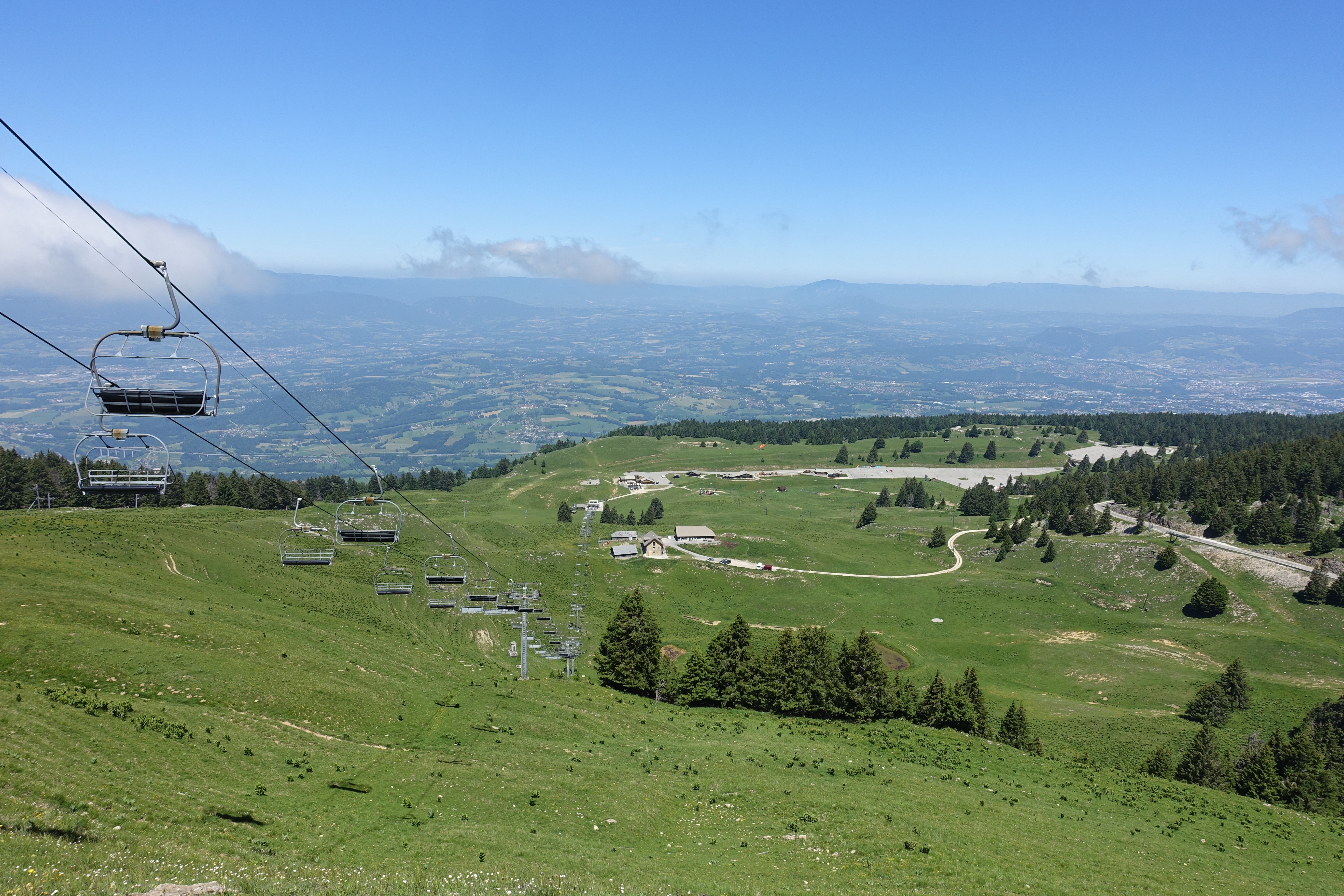
Col de la Forclaz — 1,147 m balcony over Lake Annecy facing La Tournette, one of Europe's largest paragliding sites.
Location verified by loisirs74.fr
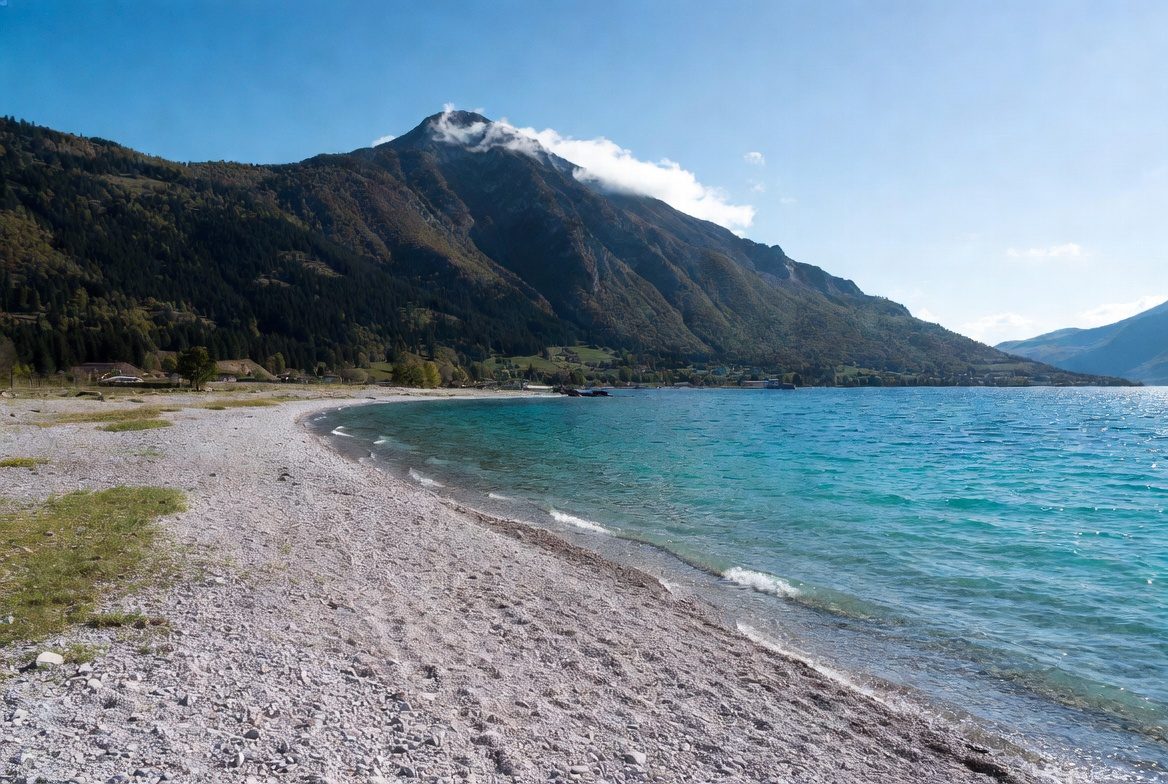
The Col de la Forclaz, at 1,147 m altitude in the Talloires-Montmin commune, is one of the most iconic belvederes over Lake Annecy. The pass links the village of Talloires, on the lake's eastern shore, with the Montmin valley descending towards Vesonne. It offers a panoramic view of the lake, the Bauges peaks and La Tournette (2,351 m).
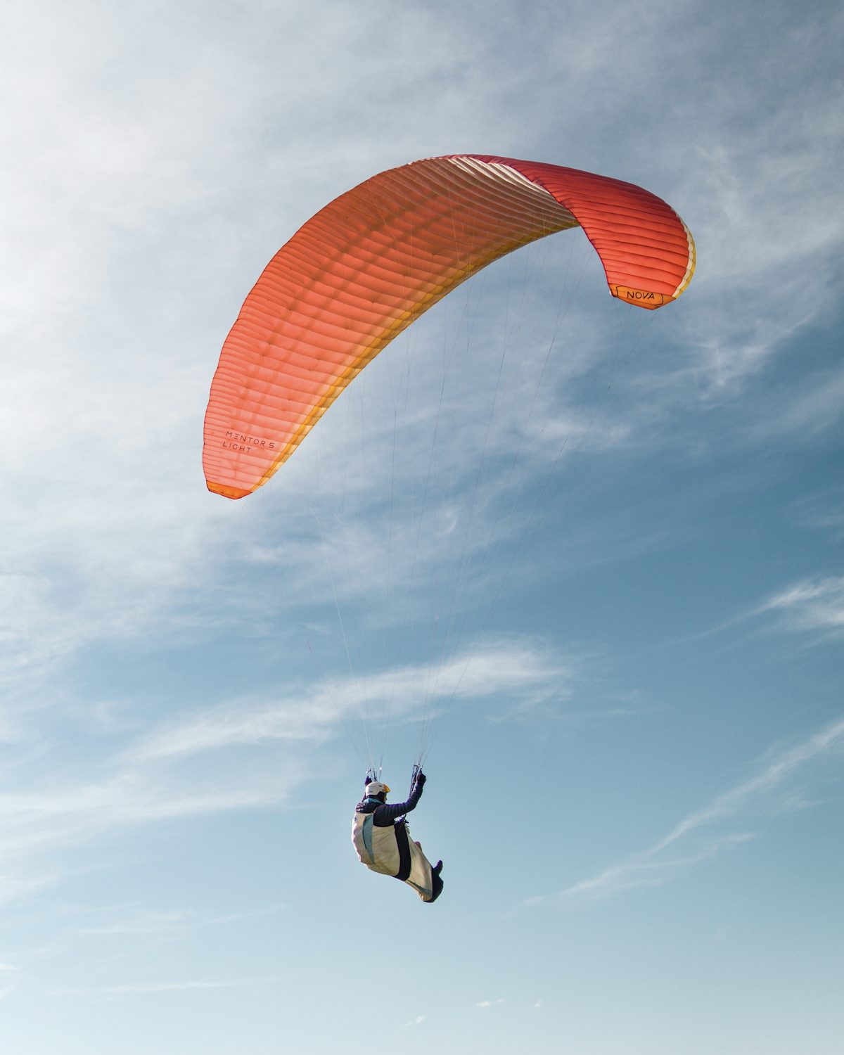
Above all, it is a world-class paragliding site: thanks to its aspect and near-daily thermals, the take-off area — set up by the commune and the FFVL — can host up to 200 flights per day in peak season, making it one of the most frequented spots in Europe. Several local schools (Aerodream, Flyeo and others) offer tandem baptism flights from around €100 depending on the package and flight duration.
The col is also a starting point for the area's best-known hikes: the La Tournette ascent (5-6 h, +927 m elevation gain, exceptional panorama over the lake), the Seven Fountains loop (≈ 1 h, family-friendly), and loops towards Mont Lachat. The road is also popular with cyclists climbing from Talloires (≈ 8 km, 7% average gradient) or from Vesonne on the Montmin side.
Free access by road from Talloires or Montmin. Several car parks at the col (can be saturated in July-August). A panoramic restaurant with a lake-facing terrace rounds out the stop. Best season is May to October: the road may close in winter depending on snow.
From Annecy: drive the lake's eastern shore (Veyrier, Menthon, Talloires) then climb to the col on the D42 (8 km, 7% gradient). Allow 40 min from Annecy.
Open in MapsNo regular bus serves the col. Seasonal shuttles from Talloires possible in summer.
Open in MapsCycling climb from Talloires (≈ 8 km, 7% average) or from Vesonne on the Montmin side. Very popular ascent for Annecy cyclists.
Open in MapsTransport data verified on 2026-06-15 · source transport.data.gouv.fr (Licence Etalab 2.0)
Been there? Share your photos — we'll add them to this page with credit. Tag #loisirs74 or email photos@loisirs74.fr
No, road access to the col is entirely free. Free parking. Paragliding flights, the restaurant and some shuttles are paid.
By car on the D42 from Talloires (8 km, 7% gradient). By bike, it's a very popular climb for Annecy cyclists.
Yes, several schools (Aerodream, Flyeo and others) offer tandem flights from around €100 depending on the package and flight duration. Booking advised in peak season.
Up to 200 flights per day in peak season, making it one of Europe's most frequented paragliding sites.
The La Tournette ascent (5-6 h round trip, +927 m), the Seven Fountains loop (1 h, family), and several loops to Mont Lachat and the Montmin valley.
May to October. The road may close in winter depending on snow. In summer, arrive early for parking and to enjoy the morning cool.
Yes, a panoramic restaurant with a terrace facing Lake Annecy is at the col. Ideal for lunch after a hike or flight.
The col itself is accessible by car without difficulty. The panoramic terrace and restaurant are accessible. The hiking trails are not adapted for wheelchairs.
Multi-source verification at publication. Information may change — confirm with the official operator before travelling.
Nearby
Other places to explore in the area and in the same category
Free
Shaded confidential beach: a vast lawn with large trees, set away from the bustle of Talloires centre. Exceptional view of the Château de Duingt.
 Free
Free
Sand and lawn beach at the southern tip of Lake Annecy, floating pontoon, adjoining water-sports centre. Bordered by the Bout du Lac nature reserve. Accessible.
 Paid
Paid
K2 Parapente: tandem paragliding flights from Col de la Forclaz over Lake Annecy, landing at Doussard beach. April-October season.
 Free
Free
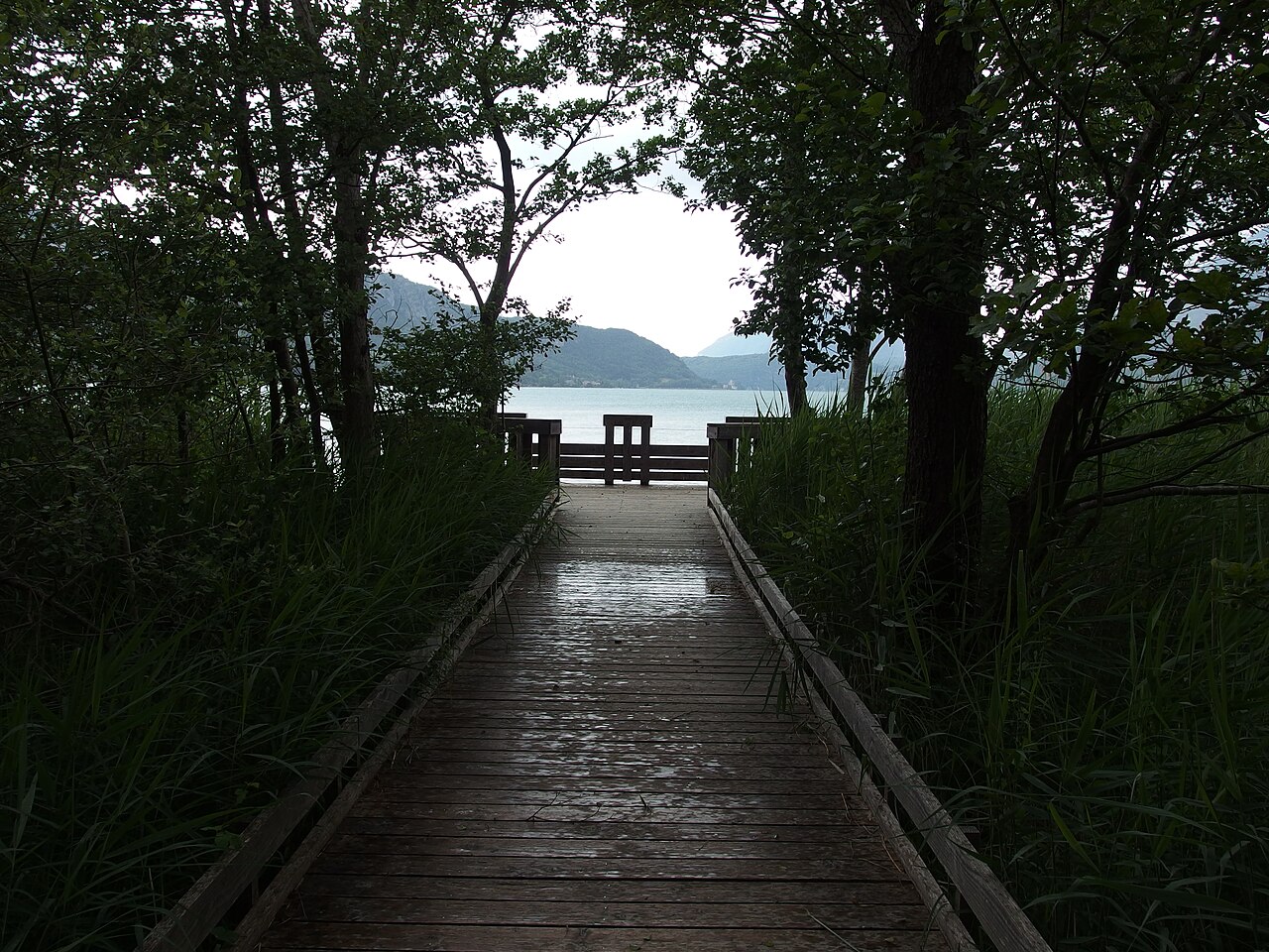
Reedbeds, marshes and Ire delta at the south end of Lake Annecy: walkway, observation tower and water birds. Free access, managed by Asters.
 Free
Free
Panoramic platform at 1254 m, remnant of the former Mont Veyrier cable car. Sweeping 180° view over Lake Annecy, Bauges and Mont-Blanc. Free access year-round.
 Free
Free
Bauges massif plateau at 1699m, 360° view Mont Blanc and Lake Annecy, family ski resort and summer activities, free access 20 min from Annecy.